Saturday, 9 November 2013

Short Stories During a Long Passage


900 miles to go!


Musings during a 9 day open ocean sail to St. Maarten


Nowhere to run, nowhere to hide

The one thing you can expect in a long sail is change.  Our sail of nearly 900 miles from Bermuda to St. Maarten (note Dutch spelling) would be no exception, which is why we waited for the best “weather window” possible.

There were times when all the sails were up, motor off and we were travelling at 6 to 7 knots you’d think, ‘if it could only remain like this for the next week’….  But then you’d snap out of it and know that it won’t.


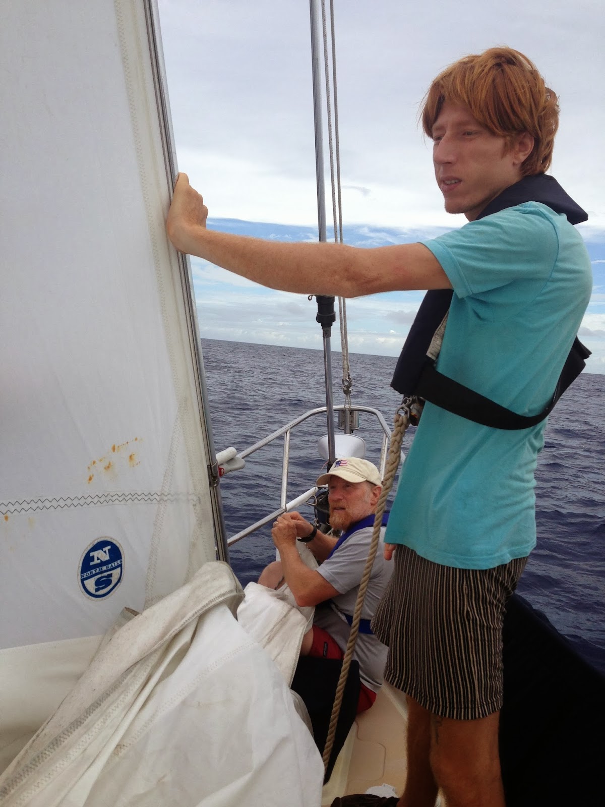
Curtis Smith and the deep blue

On Halloween Eve (when all the scary things come out), we sailed into a storm.  Winds had been 20 knots and we were sailing with the Sayes self-steering mechanism.  This device has its own little sail that “feels” the wind and adjusts the rudder to keep the same point of sail.  During my watch from 9 pm to midnight, it had been solidly following the course we wanted.  I also saw lightening at several locations in the distance.  Then around 11 pm, Alaria started to gyrate off course – the winds were also picking up to 25 knots so Ansley and I decided to take in the forward most sail (a jib called a “Yankee”).  Ansley’s watch was midnight to 3 am and winds remained relatively high.  Then Paul took over and during his watch he saw the lightning was much closer and in one location that he thought would be best to avoid.  However, about then the wind died… so to get the boat to move, he decided to pull the Yankee back out.  Then the storm hit.  Winds came up, he needed to get the Yankee rolled back onto the forestay but there was a knot in the jib sheet (the rope that controls the Yankee).  We could all hear the commotion so we all got out of bed, we tried to get the Yankee in… winds were now 35 knots (a full gale!), but the jib was stuck.  Everything was rattling as we worked to get the sail in.  The buffeting of the sail was so great that the far edge (called leech) was shredding. The sail was at risk to being shred to pieces…..

Sun setting below storm clouds
We feverishly worked to stabilized the sails.  Then we waited for sunrise.  With first light we found the roller furling had jammed from all of the flailing lines.  The loose jib sheet had worked the knot out from its end and had tied itself a massive knot.  We worked to free the knot, rewrap the furling system and wait for lower wind to take down the wounded Yankee jib to repair it.

Tattered sail and a gordian knot!
Tattered sail losing its leech tensioning line

Out at sea, you have to deal with what has been served to you.  In a boat that sails at 5 – 6 knots, there’s nowhere to run and obviously nowhere to hide.   Also, you have to deal with and fix your problems.  It was time for me to get out my sail sewing equipment.

Repairing the tattered sail
When you have a sail in the cockpit, you appreciate how big those suckers are.  We found the outer edge, the leech had frayed and most of the stitching had pulled out.  There is a line (called the leech line) that tensions the sail.  It had come out over long stretches of the sail.   Also the part of the sail that attaches to Alaria (the head luff cable) had started to tear.  If that had continued, the sail would be unusable.


Paul Calder stiches one end of the sail
It was clear, what we had to do.  We must sew the entire edge of the sail.  We needed to reinforce the key parts that had come apart.  So, for the next two days Paul and I sewed from sun up to sunset.  Sail needles are robust and long.  To push them through a sail requires you start the penetration and then push the needle through with a pad strapped to  the palm of your hand.  Each stitch takes a few seconds.  The job never seems to end.  After the first day, my fingers ached but the next day we finished.

Bob stitching the other end of the sail

Mornings are often the calmest period so that’s when we all set to flying the Yankee again.  We hanked her on and off we sailed.  We all saw how valuable that sail is… we were sailing again over 5 knots under the silent power of the sails.  Whew…

Moment of truth - hanking on the repaired Yankee
Yankee jib back in service!!

OUR GUARDIAN ANGELS

In days past, schooners would leave port unknowingly sailing into a hurricane with all hands lost.  Now we have satellite images and weather forecasts to prevent that from happening.  However, after a few days, any prediction you had on the day you departed becomes increasingly suspect.  Weather changes as do forecasts.  We are off on a 900 mile extended journey… we needed and had our guardian angels.

Sailing into building seas
Several friends became our weather watchers who would send short 130 character messages with weather updates.   Our three key weather watchers were my close friend Malcolm Burson (sailing buddy in Maine, now working with the Conservation Law Foundation), David Duggins (University of Washington’s captain of their research vessel and a first class marine ecologist) and Lew Incze (a professor at the University of Maine, Oceanographer and life-long sailor).  These guys kept us in the loop over our entire passage.

Hurricanes scared us most.  The frequency of their formation was declining during October and into November but they are not unheard of in November.  In 1999 Hurricane Lenny reeked havoc throughout the Caribbean around the middle of November.  The only way we know if we have something that serious coming our way is via our guardian angels.  Thank heaven for them…..
Rainbow
Over our long passage we did get odd weather.  The reliable Trade Winds were unreliable.  We asked our guardian angels what we can expect from the weather and they told us.  It wasn't always exactly what we wanted to hear but at least nothing too serious was coming our way.  Whew…


LESSONS ON SUSTAINABILITY

Alaria is a sailboat but during long ocean passages, it is an island supporting four people. We carry only 70 gallons of freshwater, we only have fuel enough to power the boat for about half the trip… we must make do with what we have.

Water is key.  We rigged a saltwater foot pump in the galley (kitchen) to wash dishes and anything that does not need freshwater.  We cannot take showers.  At best we can sponge off the sweat and sunscreen but that’s it.  Sometimes we can capture rainwater to fill the water tank but our long passage had plenty of wind but not much rain.  Our water conservation was so austere that we used less than 35 gallons of water for the four of us over a 9 day period!

At night we turn on the LED lights to illuminate the cabin. They and two fans use extremely little electricity. We listen to music but we carefully watch the battery charge level.  Alaria employs a sort of a ‘hybrid’ electrical system that charges batteries from wind, sun and engine when it is on. 

The ocean’s salt water “works” corrosively on all of our electronics.  We lost the use of some lights such as the masthead light.  Our trouble-shooting was constant.

Trouble-shooting an electrical glitch
Knowing we are in the middle of the ocean requires we watch our consumption of food, energy and water.  We sail to save fuel but when we sail we must be especially careful about the energy we use since the solar and wind generators take a while to charge the batteries.

None of this is surprising to anyone.  However, living at sea for extended periods sure sharpens your focus on what you need vs what you might want when you are on the mainland.


OUR MOVING ISLAND AND ITS VISITORS

On a 900 mile journey it strikes you…. There is NOTHING for hundreds of miles all around you but ocean.  Nevertheless, we did get visitors. 

Our "Long-Haul" of 2357 miles

Aside from the spotted dolphins that followed us periodically, birds were our most common visitor.  We saw beautiful tropic birds with their long white tendril gracefully trailing from their tail, odd falcons, and migrant birds.  One cliff swallow few up to us and landed on Alaria to rest.  It is a handsome bird.  We offered it water and ground nuts but it wasn’t interested.  However, the next day it returned and roosted on the rail around the boat and then flew into our cabin to make itself at home. It watched us prepare dinner from a perch.  Then it sat on Ansley’s shoulder for an hour.  We moved it to our library (which is a very stable area) where the swallow slept all night.  In the morning, we were in sight of St. Maarten and the little swallow took off straight for some nice cliffs on the island.

Cliff sparrow meets Curtis Smith our on-board ornithologist
Cliff swallow adopts Ansley Sawyer who prefers birds that are roasted on the grill

Almost every night flying fish fly into our boat.  When we see them during our watch, we grab them and put them overboard.  However, so do not make it.  Flying fish don’t really fly, they glide on long wing-like pectoral fins.  Their body is triangular in cross section to be aerodynamic and so they can see down towards the water they are flying over.  The dead flying fish were used for bait as we sailed along but we had no luck with them.

Bob with one of the morning's flying fish (small species)

Paul with a larger flying fish he wants to use as bait
Not all of the visitors were accidental.  Paul was the fisherman of the group.  He baited hooks and trawled for fish everywhere we went.  We had sushi as a benefit of his actions.  However, on our last full day of travel, he hooked a marlin!  It was an amazing fighter that got to the boat where we all could see it before it threw the hook and was back to its ocean realm.  The marlin real treat to see.

Our hooked marlin!  Played it for 5 minutes before it threw the hook


LANDFALL!!!

On the evening of 6 November, we could see the glow of St. Maarten and Anguilla.  It is the first sign of civilization we had seen since leaving from Bermuda on 29 October.  I got up a bit early to see where we were … we had arrived at St. Maartin.  The sunrise was beautiful… especially because it was over land for the first time in ages (it seemed).
 

Landfall St. Maarten!


Making landfall by sea has a more profound impact than you might expect.  Of course seeing nothing but sea for several days can have this effect.

St. Maarten and the island chain before us

Upon arriving we had to bring the sails to a sail-maker to repair properly.  We hope this is all we’ll have to do with the sails.

Sails going to be repaired

Sails being professionally repaired.


The day of our arrival, George Stoyle (graduate student studying reef fish assemblages) joined us having flown in from the UK. Our “long-haul” sailors arranged their flights home and we worked to repair little odds and ends of things that needed attention.

George and I arranged to work with The Nature Foundation which is a federally funded entity focused on conservation of St. Maarten’s coral reefs. 

On day two, George and I were diving on the reefs, Ansley was fixing things (as he’s wont to do) but Paul and Curtis where working away as well.  Curtis is booked to fly home tomorrow morning.  So this is the end of the “Long-haul” crew and the beginning of the next chapter of coral reef research along the eastern Caribbean.

The "Long-Haulers" last evening together


Tuesday, 29 October 2013

The bigger picture


Our next leg from Bermuda will be about 900 miles and that could take us 9 days.  We carry only enough fuel for about 3 days.   So studying the wind becomes central to our travel plans.  We’ve been doing this and today looks like our day to move to St. Maarten.

While I do not expect anyone to be waiting for the next installment of my blog, I thought I’d take this opportunity to describe a bit of the bigger picture…..


So Why Do This Research?

Science requires you attend to details but sometimes it is good to step back and consider the bigger picture.  In case the science interests you, read on….

Science of the bigger picture
We live in the Anthropocene.  This is the most recent period of significant biological change.  Paleontologists have names for each period when life on Earth changes. Animals with shells and hard parts appeared over 500 million years ago during a period called the Cambrian.  Dinosaurs ruled land during the Triassic, Jurassic and Cretaceous periods of the Mesozoic Era.  More recently, in the Cenozoic Era of the Eocene period, modern reef fishes evolved.  During the Pleistocene glaciers covered the poles and during the Holocene, humans evolved.  The Anthropocene describes the period when the biosphere was clearly affected by human activity.

There is no place on Earth where human presence cannot be detected.  Some impacts are conspicuous such as forest clear-cutting but others are subtle such as global warming and ocean acidification of our world.  The scale of the climate and atmospheric effects is huge – in some ways it is global.  This can have profound effects on lots of critters but none are more affected than coral reefs.  For example, when ocean temperatures coral reef exceeds its average summer temperature by more than about 2 degrees C, corals bleach.  Coral bleaching occurs when tiny, but useful, algae that live within the corals are expelled and corals bleach white.


Bleached brain corals (right side of left photo is not bleached). Bonaire 
Bleached star coral in Bonaire 2010
Another bleached brain coral from Bonaire 2010
Most climate scientists have concluded that the burning of fossil fuels creates a greenhouse condition in which sunlight turned into heat when it strikes Earth, becomes trapped in this greenhouse.  Carbon dioxide also readily reacts with water creating carbonic acid.  This resulted in the acidification of the world’s oceans.

Plants and animals that create limestone skeletons such as lobsters, sea urchins and coral, invest metabolic energy to calcify.  With ocean acidification, the cost of doing the business of calcification has gone up.  Many reef scientists fear that thermal-stress of global warming and ocean acidification have created a ‘double whammy’ that may have serious synergistically negative impacts on coral reefs.

Getting from what we know, to what we don’t know
Reef corals have declined in abundance over the past half-century (at least).  Coral reefs as with most ecosystems are named for their dominant organism, reef corals.  Since reef corals are declining in abundance, coral reef ecosystems are threatened.  On many reefs, as corals decline, seaweed increases in abundance.  Given that in the 1970s seaweed was rare throughout the Caribbean, the trend is clear but what drives this trend is hotly debated. 

Coral reefs in Jamaica (Discovery Bay) shifting to seaweed reefs between 1978 and 1988
Top two and bottom two photos were taken at exactly the same locations.

Could climate change and ocean acidification have caused the decline in coral reefs?  Perhaps.... but there are other, non-mutually exclusive ideas as well.  Some scientists argue instead that the increase in seaweed is due to nutrient increases that stimulate their growth.  Seaweed can smother and even poison coral so that’s a plausible explanation.  Others argue that over fishing coral reef fishes – especially those that graze down seaweed resulted in the blooms of algae.  Still others wonder if fish are important at all perhaps it was the decline in grazing long-spined sea urchins that resulted in the seaweed bloom.

The fact is, not all coral reef ecosystems have declined. The coral reefs in Bonaire remain relatively healthy with a high coral cover.  So, why have some (perhaps most) coral reefs declined but others remain healthy? 

Healthy coral reefs of Bonaire (note high coral cover, little seaweed)

Looking for the perfect laboratory
With this background, I sought to find the best place to explore the question of what’s plaguing the health of Caribbean coral reefs.  I focused on the low islands of the eastern Caribbean because they are dry and have little runoff, the Trade Winds and the north equatorial current bathes them in clear tropical seawater with a minimum of upstream pollution.  Since all of the eastern Caribbean islands are in a relatively small north to south archipelago, it is reasonable that global warming and ocean acidification will affect the reefs in similar ways.  So, by studying similar reef zones from island to island we can see if the reefs differ.  If they do, it likely the result of local factors such as the fish fauna rather than pollution, climate or atmospheric stresses.  This is not to say the other factors are unimportant but that they may not be the sole drivers of the health of coral reefs. 

The Caribbean.  Note the small dot to the north is Bermuda (image: Google Earth)

The Antilles of the eastern Caribbean.  My study sites for this expedition (image Google Earth)

How do you find the ‘pulse’ of a coral reef?  
For the last 20 years, several colleagues and I have worked to develop rapid assessment protocols for Caribbean coral reefs.  The gold standard for such assessments is the Atlantic and Gulf Rapid Reef Assessment known as “AGRRA” (http://www.agrra.org/index.html).  Over the years, research my students and I have conducted rapid assessments to characterize all the important reef organisms (especially coral, algae and fishes) with only a few dives per reef.  Since 1997 I’ve conducted AGRRA-like surveys in the Bahamas, St. Croix, St. John, Bonaire, Mexico, Belize, Honduras and Guatemala.  My work in Mexico along with AGRRA surveys at 38 other sites conducted by over 100 scientists was published in July 2003 in Atoll Research Bulletin (free to download at the AGRRA site). 

So by conducting rapid assessments on similar reef-types at the same depth allows us to determine if significant differences exist among reefs.  I'll get into the details of the differences we are looking for a bit later.  Nevertheless, if differences are found among islands, an excellent question would be, why are they different?  It is a bit premature for me to speculate on this but suffice to say, I do have a plan on how to proceed. 


Sunday, 27 October 2013

Bermuda's coral reefs


Lessons from a low diversity, isolated coral reef ecosystem

The northern most coral reefs in the world surround Bermuda.  In fact, the ‘footprint’ of  the island’s coral reefs is much larger than the island itself.  These reefs formed, as all coral reefs do, in shallow tropical seas.

Bermuda's coral reefs from space.  The green/brown 'fish hook' is Bermuda, the blue and darker circle are coral reefs.

 Corals are physiologically plants because of the tiny algae (called zooxanthellae) that live in their skin.  Those algae give the coral their color.  The algae feed the coral with sugars for growth and energy.  The coral provides habitat for the plants.  This symbiosis allows corals to grow toward the sun from a depth where they get enough light to grow.  It is actually a only a shallow depth band in which corals can live to get the light they need to grow.

Brain corals showing the color of their zooxanthellae

It is an accident of geology that causes Bermuda have these unusually expansive reefs. The island was formed by a volcano 100 million years ago but has since eroded down to a fraction of its former self.  Over the last million years, sea level has gone up and down with corals building up limestone layers each time conditions were right (underwater with abundant light) for coral reefs.  After the last ice age about 18,000 years ago, sea level was lower because lots of water was frozen at the poles.  When it rapidly melted, sea level rose faster than any coral could grow.  However, with time as the rate of sea level rise slowed the depth of the Bermuda bank was perfect for coral growth.

It is an accident of oceanography that Bermuda sits in warm tropical water capable of supporting coral reef growth.  Those two accidents of geology and oceanography resulted in the impressive coral reefs grew to what we see today.

Because Bermuda is 1000 miles from Caribbean coral reefs and is at the northern limit of coral distribution, there are fewer species of coral and of…. EVERYTHING... compared to typical Caribbean reefs.  For example, only about 20 species of coral live in Bermuda while 64 species are found in the Caribbean.

While coral reefs world wide are composed of a variety of shapes, Bermuda’s reefs are much simpler.   The reefs we saw today were strongly dominated by only a few species of brain corals.  Brain coral is so named because the grooves on the coral look a bit like the structure of a brain.  However, most brain corals are hemispherical.  So rather than seeing tree-like structures or complex branching shapes, we see a seascape of mounds. 
Brain corals mostly of the genus Diploria (for you science nerds)


The curious hemispheres of brain coral making the seascape of this Bermuda reef on the south shore
Grazing queen parrotfish and tang

Queen parrotfish over well grazed (see bite marks) reef surface
Stoplight parrotfish fleeing from me


The reef we saw was healthy.  There were lots of parrotfish grazing the algae to a thin turf.  That’s ideal but I’ll explain this in more detail later in the trip.  There were plenty of baby corals (small button size or golf ball sized corals). 


Bermuda has a low diversity reef as I explained above but that means it tends towards having monocultures.  The brain coral are mostly two species in one genus of reef coral.  It also may make it susceptible to non-native species introductions.  This has happened but one uninvited guest that did make it here is the now ubiquitous Pacific lionfish.  It is a beautiful fish with a nasty habit of eating baby reef fish.  It was introduced to Florida when Hurricane Andrew swept over the state in 1993.  It remained confined to that area for a while but then colonized the Bahamas to very high densities and quickly spread throughout the Caribbean.  No region I know has been spared.

Lionfish - the uninvited beautiful predator of baby fish


Friday, 25 October 2013

Off to Bermuda


OFF TO Bermuda

In Norfolk, Va ready to cross to Bermuda
Life at sea

Living on a 34’ boat has its challenges.  During long hauls, we sail 24 hours a day.  At all times someone is on watch.  We have to monitor where we are going, the direction of the wind and how we set our sails, other boat traffic, how much fuel, electricity and water we have.  Every nook and cranny is filled with provisions.  We have a packed refrigerator, a two-burner stove with oven and a barbeque grill.  A bimini protects us from the sun and provides a place for our solar panels.  It can be fully enclosed with several clear plastic panels that protect us from the weather but they also remove us from the environment.  With all this stuff, the challenge is not to get too complacent.

For coastal cruising we run 4 hour shifts (that is 4 hours on, 4 hours off) with teams of two.  For open ocean crossings one individual is on watch for 3 hours and then gets 9 hours off.  During the day as we cruise, we often chat about… well, everything.  So far, there’s rarely a debate.  At night, iPods come out, and the folks on watch work alone and without company.  After dark, we do not leave the cockpit to do something on the deck without waking a crew member to watch.  Then the person going forward, puts on his inflatable harness, clips it to the “jack line” (a flat strap that is secured to the outer deck of the boat from the forward cleats to the cockpit combing.  Jack lines are designed to keep you in the boat and tethered even if a large wave washes over the boat.

Sailing under light wind with carboys of extra water and fuel mounted on the starboard rail


We set out to Bermuda carrying fuel for three days of motoring but knowing the trip will be at least five days long.  We must sail and sail we did.  We had perfect sailing conditions, flat calm, and nearly gale force winds of 28 knots.  Nevertheless, we got into our 3 hours on, 9 hours off schedule – mine was from 9 to 12 (AM and PM).

Increasing winds and bashing waves at sunrise over the Atlantic

Meals are a big deal Ansley and Paul are great chefs so Curtis and I try to get out of their way and offer to clean up afterwards.  Meals range from chili to mahi mahi sushi (after Paul caught a mahi mahi).  Ansley seems able to whip up anything based on the first several things he found in the fridge.

Paul caught mahi mahi for lunch

The resulting sushi and sashimi

Crossing the Gulf Stream was a big deal.  For one thing, there are no other milestones at sea.  We had been cold crossing to the Gulf Stream and suddenly we were in cobalt blue tropical water!  Before we left we accessed "GRIB" files that model the current and predicted currents and temperatures (see photo below).  We knew where the Gulf Stream was expected to be and the blue dot on the chart showed us our current (GPS determined) location.  We were in t-shirts and shorts from then on.

Our track across the Gulf Stream (blue dot was our location when I took the photo)

Cruise track so far from the Damariscotta River to Bermuda.  Note the jog north reflecting crossing the Gulf Steam


Arriving to Bermuda's St. George harbor (left) and Customs house (right)


Alaria at the Customs dock after a 5 day 4 hour crossing